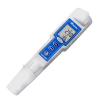
Auburn University School of Forestry and Wildlife Science identified the impact of urban land use on fish near salt marshes with conductivity loggers U24-001 and U24-002-C, a wetland research project.

What is the focus of your wetland research project?
My research involves studying the impact of land use change on wetland ecosystems. In this year's study, we looked at saltwater marshes in urban and non-urban settings in the Gulf of Mexico to see if there were changes in fish habitat or community structure, or the presence of certain fish species in a marsh . Urban land use has been shown to alter salt marshes through changes in hydrology, sedimentation and vegetation, but little is known that urban land use near salt marshes affects fish. In terms of specific settings, we studied the surroundings of the three creeks, and the surroundings of the Sangou forest. We used HOBO U24-001 and U24-002-C conductivity loggers to measure the salinity and temperature of the water at each station.
How is the logger deployed?
We deploy one HOBO U24-001 and U24-002-C conductivity logger per stream. I used PVC pipe as a lumberjack and I drilled and used the top hole for the screw that comes in handy when unloading the data. I attach the PVC pipe to a sheathed cable and then wrap the cable with a clinker block that I run every low tide to a depth of 4 to 5 feet. People in uptown have good access to the creek and I don't want anyone bothering with my equipment or possibly stealing it. Therefore, it is important that the horse is relatively concealed. During the deployment process, let me get the correct data every time I have installed hoboware on my laptop. So I put some data in the fields and do a quick check with the software to make sure everything is ok.
How do loggers measure and unload?
I have records sampled every five minutes. I might get more frequent measurements, but it's definitely beneficial that it's set more often. We let loggers fill up the data for 64 days, and we'll go sell the data every two months. We use a HOBO data shuttle offload. In terms of traffic to these sites I also try to clean up records and case points like barnacles or something growing on it, then put U24-001 and U24-002-C.
What is your analysis of the data shown?
The temperature of the water that ended up being very similar between the urban and reference creeks, while the salinity ended up being lower in the urban creeks. Salinity fluctuations are carried more rapidly in urban rivers as well. In these sites you have a lot of hard surfaces, pavements and roofs, and there are more sites with fresh water inputs and forests. In general, the salinity levels during the study ranged from straight freshwater to upwards of 25 parts per thousand. The data not only gave us a picture of what happened in the creek and what was the difference in land use around it, but also allowed us to see what happened when the storm system was going through, and what happened to the fish afterward. This is the real advantage, every five minutes, samples every hour. It would be nice to have more documented data showing that storms, which I thought would have an effect on salinity and temperature, actually do have an effect, rather than just saying it's interesting.
What are the special advantages of the HOBO U24-001 and U24-002-C conductivity loggers for this item?
We consider the size of the log to be an advantage, as smaller loggers may be more easily lost. If you have something small, it could easily become covered in barnacles and I wouldn't get data anymore. Being able to contact Beijing Cisco Keyi Instrument Co., Ltd. at any time with questions is also a key advantage, as it allows us to track salinity and temperature conditions at six different locations.